Apple Maps Is Painting Our World Strange
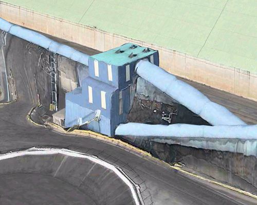
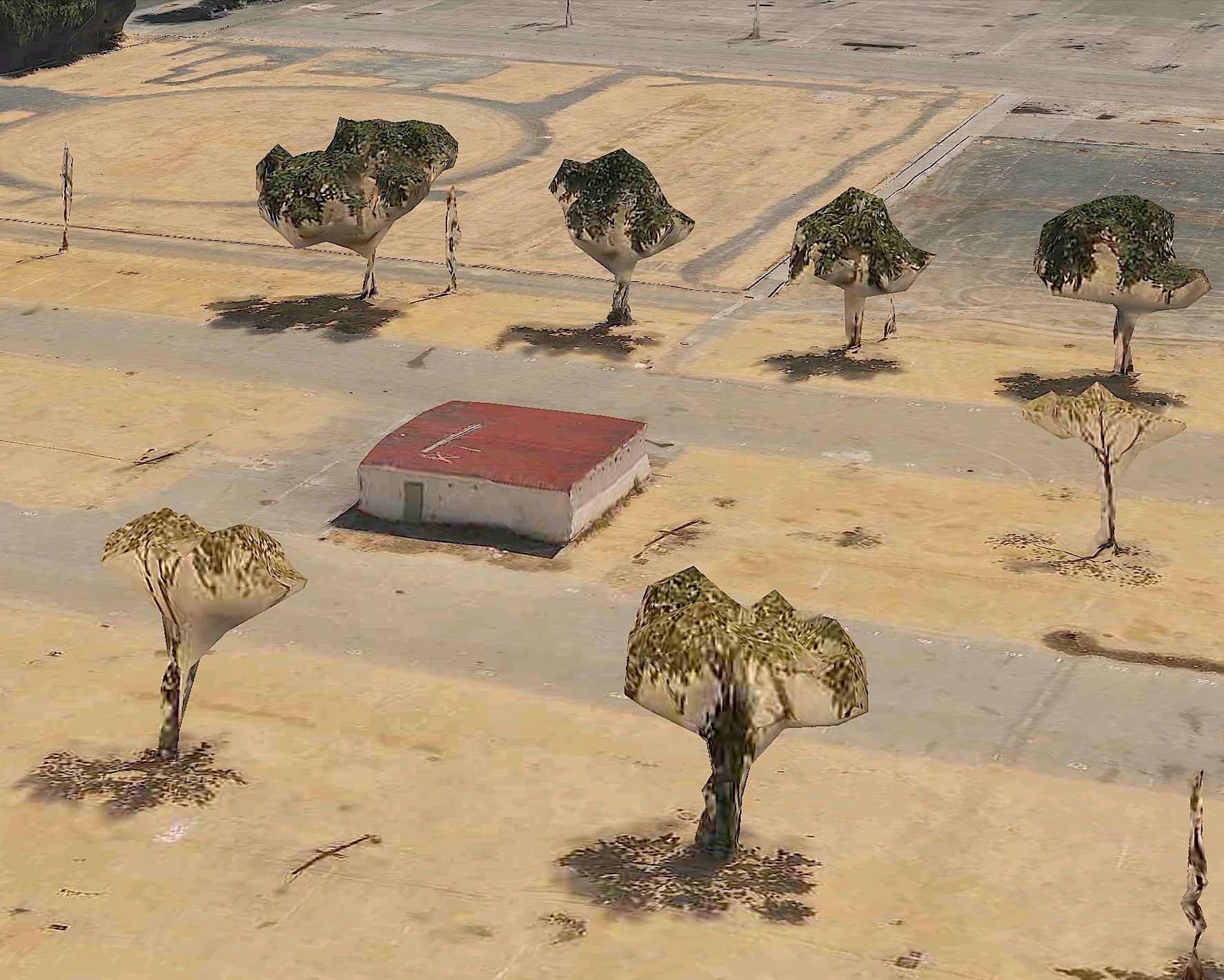
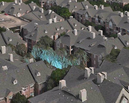
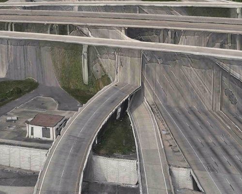
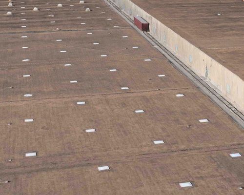
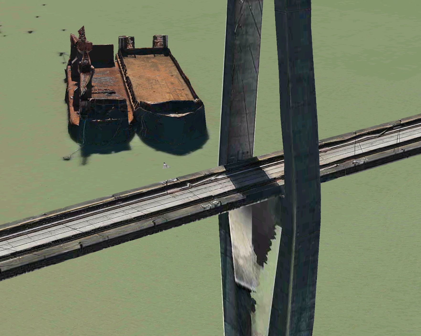
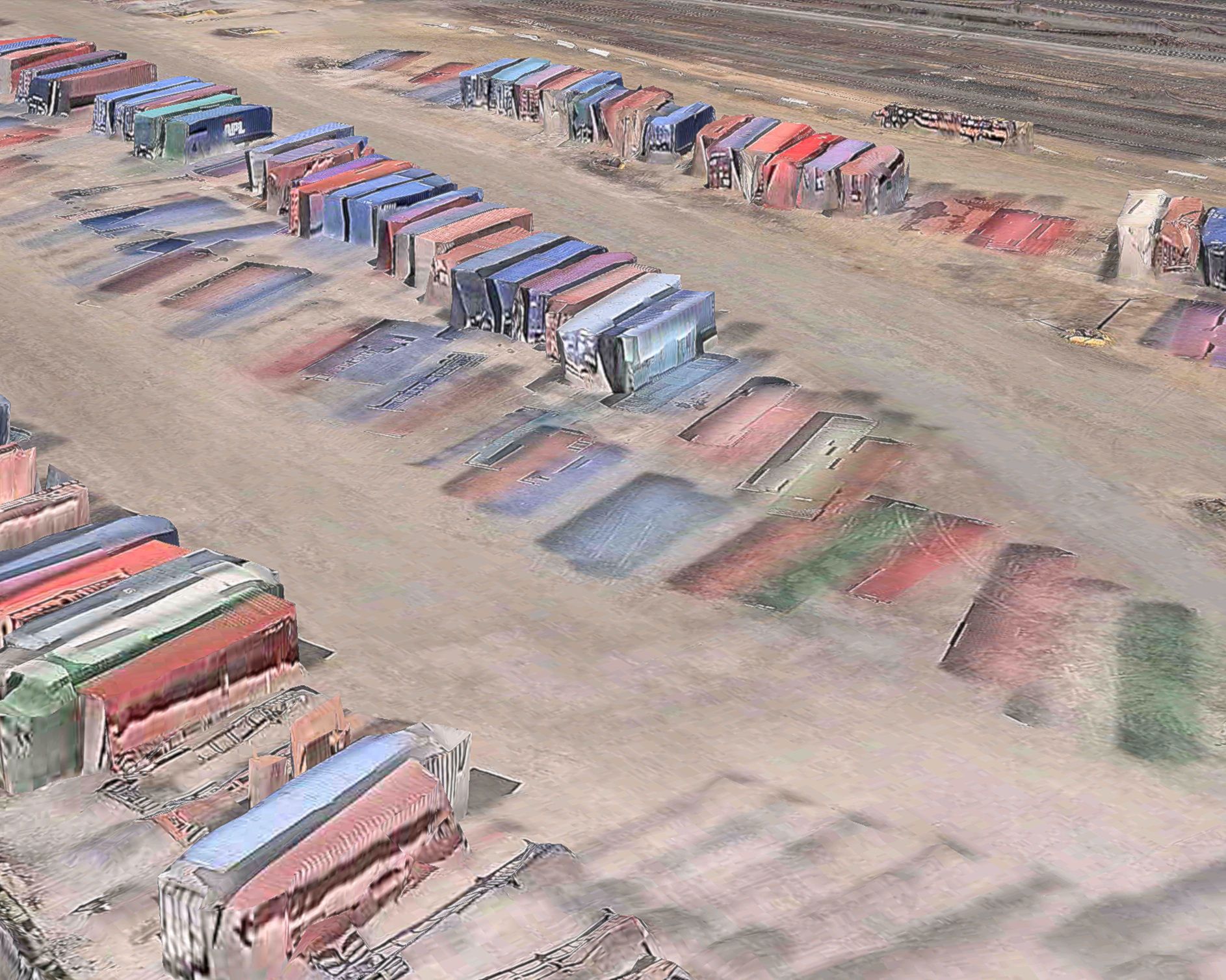
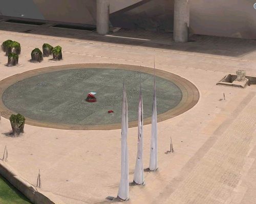
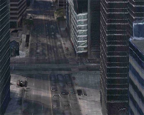
The Rendering Eye: Urban America Revisited presents 3D screenshots of the urban US as they appear in Apple Maps: deserted streets, post-apocalyptic buildings and industrial plants, melting harbors. Cars and boats turn into shadows, trees into sculptures, containers into wax. Although the algorithms trace the contours of the world with mimetic precision, the universe of Apple Maps is baffled by reality. The software, originally developed for seeker missiles, was declassified a few years ago. It creates 3D color models from aerial photography, accurate to six inches, based on missile targeting technology. The images it now produces are like the dystopian metropolises of Blade Runner, the Expressionist architecture in The Cabinet of Dr. Caligari, the future in SimCity, or Camille Pissarro’s Impressionist boulevards.
The cityscapes captured by artist REGULA BOCHSLER for the publication are abstract, machine generated, and cold. And yet they are poetic, not least because of their “mistakes,” which give them a painterly composition. Bochsler and historian Philipp Sarasin explore the implications of these algorithmic cityscapes, emphasizing the impact made by this technologically advanced rendering of our “new world” on photography and the media.
032c spoke with Bochsler about the project and her fascination with the images.
What attracted you to these images?
REGULA BOCHSLER: When I first saw them they really hit my eyes—never before had I seen such pictures of the world. The mixture of hyperrealism and surrealism as well as the gloomy, almost post-apocalyptic ambiance.
Is there something seductive for you in the fact that the technology’s glitches are so apparent?
The glitches were the starting point of the project—they make the pictures so fascinating for me. It almost seems as if the machine had become an artist, altering the world according to its gusto and its inspiration. It became almost like an addiction for me to fly over the 3D worlds, looking for all the unexpected and often overwhelmingly beautiful pictures that result from the glitches. I search for these pictures in my work, similar to how a photographer wanders across a city with his camera, choosing the framing and slightly de-skewing the contortions of the screenshot that are due to the angle of vision that the program forces upon its users.
Can you explain the technology developed to render these images and its relationship to military technology?
Because Apple is so secretive, little is known about the technology. What we know for sure is that it was originally developed by Saab’s military technology division in Sweden and that it involves declassified technologies for target-seeking rockets and missiles. As a spin-off from Saab, the firm C3 Technologies further developed the software for civilian applications, and was acquired by Apple in 2011. In the book, writer Tom Simonite explains that the aerial pictures used for Apple Maps are captured from airplanes that carry a specially designed set of cameras which takes overlapping pictures of the ground, comparable to the cameras that Google put on its street-view cars. These aerial pictures are then used to calculate the 3D shape and size of the terrain, buildings, bridges, etc.
These are all aerial views. Is that something that interests you, the fact that it’s not civilian technology?
If we follow the dictum of the late German media theorist Friedrich Kittler that all media is the “misuse of military equipment,” it should come as no surprise that Apple Map’s renderings are closely related to military technologies. At the same time, the sight of our world from the air has been a fascination for us since they built the first balloon. Today the Flyover App of Apple Maps is the cheapest and most comfortable way to “fly” in order to view the world from above. On my “discovery flights” I tend to forget that this program has been developed for military use because I almost get drunk from its visual appearance. My fascination is comparable to the one of Félix Nadar, the French photographer and balloon pioneer, who took the first aerial view in the history of photography. But unlike Nadar, who risked life and limb and whose wife was severely injured in a balloon accident, I comfortably sit on my sofa and enjoy the new vision of the world that Apple Maps offers me.
The subtitle is “Urban America Revisited.” How have these images altered your perception or understanding of America?
Knowing and seeing is not the same thing for me. Although I knew that American cities have been laid out for private transportation (that is, cars), I was stunned to see how this had influenced the layout of its cities. I also discovered the fringes of the city, all the places where no visitor ever sets sail, the waste dumps, the crumbling factories, the purification plants, the car mortuaries, the scrap yards, and the wastelands. I developed a kind of morbid fascination for the dark side of our civilization. In many ways these places are terrible, but visually they are incredibly thrilling.
The Rendering Eye: Urban America Revisited by Regula Bochsler & Philipp Sarasin is published by Edition Patrick Frey (Zurich, 2014).
